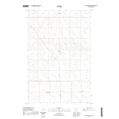
2020 Map of North Fork Horse Creek
USGS Topo · Published 2020About this map
N Fork Horse Cr serves as a central drainage point in this remote section of McCone County, Montana, carving through a landscape defined by seasonal watercourses and gravel routes. The map documents the intricate hydrography of the High Plains, where the E Fork Prairie Elk Cr and Middle Fork McGuire Cr weave through complex topography. This modern survey illustrates the sparse human footprint in the region, centered primarily on the infrastructure of Weldon Rd and Dinger Rd. The layout of the S Weldon Loop and the surrounding township boundaries, such as t21n r46e, highlight the enduring grid of the Public Land Survey System that organizes this ranching and grazing territory.
Find a feature on this map
10 named features on this map. Tap any name to fly to it.
Don’t see what you’re looking for? This feature index may not catch every label — zoom into the map to look around manually.
Map Details
Editions of this 2020 North Fork Horse Creek Map
This is the sole edition of this map. No revisions or reprints were ever made.
Other maps of this area

1954 · Glendive
USGS Topo · 1:250,000

1957 · Glendive
USGS Topo · 1:250,000

1958 · Glendive
USGS Topo · 1:250,000

1982 · Circle
USGS Topo · 1:100,000

1983 · Youngquist Mine
USGS Topo · 1:24,000
1983 · Figure Eight Creek
USGS Topo · 1:24,000

1983 · Brockway NE
USGS Topo · 1:24,000

1983 · Haynie Reservoir
USGS Topo · 1:24,000

1983 · Pedigo Coulee
USGS Topo · 1:24,000

1983 · North Fork Horse Creek
USGS Topo · 1:24,000