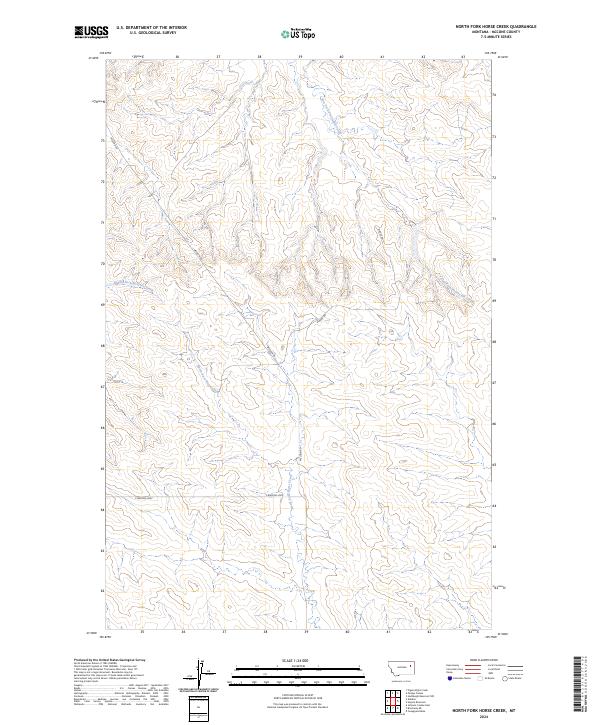
2024 Map of North Fork Horse Creek
USGS Topo · Published 2024About this map
North Fork Horse Creek flows through this corner of McCone County, Montana, carving a complex system of drainage basins that define the local topography. This 2024 U.S. Geological Survey representation documents the rugged breaks and coulees where the East Fork Prairie Elk Creek and Middle Fork McGuire Creek originate. The landscape is primarily organized by the Public Land Survey System, with township boundaries like t21n r46e providing the structural grid for this rural expanse.
Find a feature on this map
10 named features on this map. Tap any name to fly to it.
Don’t see what you’re looking for? This feature index may not catch every label — zoom into the map to look around manually.
Map Details
Editions of this 2024 North Fork Horse Creek Map
This is the sole edition of this map. No revisions or reprints were ever made.
Other maps of this area

1954 · Glendive
USGS Topo · 1:250,000

1957 · Glendive
USGS Topo · 1:250,000

1958 · Glendive
USGS Topo · 1:250,000

1982 · Circle
USGS Topo · 1:100,000

1983 · Youngquist Mine
USGS Topo · 1:24,000
1983 · Figure Eight Creek
USGS Topo · 1:24,000

1983 · Brockway NE
USGS Topo · 1:24,000

1983 · Haynie Reservoir
USGS Topo · 1:24,000

1983 · Pedigo Coulee
USGS Topo · 1:24,000

1983 · North Fork Horse Creek
USGS Topo · 1:24,000