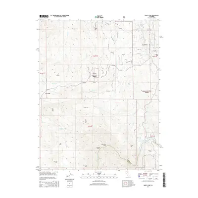
2015 Map of North Fork
USGS Topo · Published 2015About this map
The Sierra National Forest dominates much of this landscape in the Sierra Nevada foothills, where the settlement of North Fork serves as a geographic center. The terrain is defined by dramatic elevation changes, from the high points of Smiley Mtn and Fish Creek Mtn to the flat-topped Kennedy Table and Bug Table formations in the south. Water is a constant presence, with Fine Gold Cr and Fish Cr carving through the valleys toward the San Joaquin River and Kerckhoff Lake at the Fresno County line. For local historians, the map preserves the locations of North Fork Cemetery and Walker Cemetery, alongside smaller settlements like Fine Gold. The road network, including N Fork Rd and Crane Valley Rd, illustrates the access routes through these timbered and mountainous tracts.
Find a feature on this map
72 named features on this map. Tap any name to fly to it.
Don’t see what you’re looking for? This feature index may not catch every label — zoom into the map to look around manually.
Map Details
Editions of this 2015 North Fork Map
This is the sole edition of this map. No revisions or reprints were ever made.
Other maps of this area

1904 · Kaiser
USGS Topo · 1:125,000

1912 · Mariposa
USGS Topo · 1:125,000

1916 · Sulphur Springs
USGS Topo · 1:24,000

1919 · Sulphur Springs
USGS Topo · 1:31,680

1942 · Millerton Lake
USGS Topo · 1:62,500

1945 · Millerton Lake
USGS Topo · 1:62,500

1947 · Mariposa
USGS Topo · 1:250,000

1948 · Mariposa
USGS Topo · 1:250,000
1953 · Bass Lake
USGS Topo · 1:62,500

1953 · Shaver Lake
USGS Topo · 1:62,500