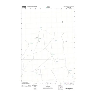
2010 Map of North Laidlaw Butte
USGS Topo · Published 2010About this map
North Laidlaw Butte and a series of volcanic features define this high-desert landscape in Blaine County during the early 21st century. The map reveals a sophisticated network of water management through numerous small catchments, including Northside Reservoir, Snowdrift Reservoir, and the curiously named Bullshot Reservoir. These isolated water sources are essential to the open rangeland, where cattle grazing and light aviation intersect at Hollow Top Airport.
Find a feature on this map
17 named features on this map. Tap any name to fly to it.
Don’t see what you’re looking for? This feature index may not catch every label — zoom into the map to look around manually.
Map Details
Editions of this 2010 North Laidlaw Butte Map
This is the sole edition of this map. No revisions or reprints were ever made.
Other maps of this area

1955 · Idaho Falls
USGS Topo · 1:250,000

1958 · Idaho Falls
USGS Topo · 1:250,000

1972 · North Laidlaw Butte
USGS Topo · 1:24,000

1972 · Little Park
USGS Topo · 1:24,000

1972 · Bear Den Butte
USGS Topo · 1:24,000

1972 · Laidlaw Butte
USGS Topo · 1:24,000

1972 · Bear Park West
USGS Topo · 1:24,000

1972 · Inferno Cone
USGS Topo · 1:24,000

1972 · Blizzard Mtn South
USGS Topo · 1:24,000
1973 · Fissure Butte
USGS Topo · 1:24,000