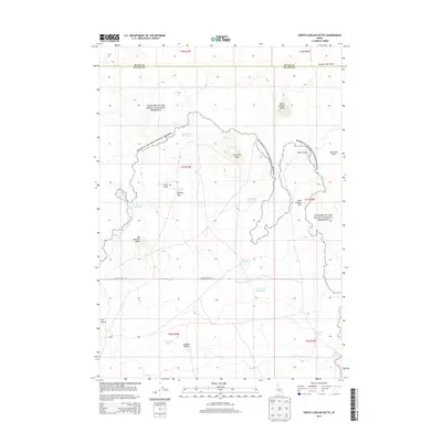
2013 Map of North Laidlaw Butte
USGS Topo · Published 2013About this map
Craters Of The Moon National Preserve dominates this section of the Snake River Plain, where volcanic geography creates a stark and distinctive environment. The landscape is defined by vast basaltic formations including the Sentinel West Flow and Sawtooth Flow, alongside prominent cinder cones and depressions like Snowdrift Crater and Bowl Crater. Human utility in this arid region is marked by a network of scattered water catchments, such as Snowdrift Reservoir, Bullshot Reservoir, and Northside Reservoir, which support local land use. Transportation is limited to a few secondary routes like Laidlaw Park Rd and the small Hollow Top Airport. Named heights such as North Laidlaw Butte and Big Blowout Butte provide vertical relief against the expansive flats of Little Laidlaw Park.
Find a feature on this map
30 named features on this map. Tap any name to fly to it.
Don’t see what you’re looking for? This feature index may not catch every label — zoom into the map to look around manually.
Map Details
Editions of this 2013 North Laidlaw Butte Map
This is the sole edition of this map. No revisions or reprints were ever made.
Other maps of this area

1955 · Idaho Falls
USGS Topo · 1:250,000

1958 · Idaho Falls
USGS Topo · 1:250,000

1972 · North Laidlaw Butte
USGS Topo · 1:24,000

1972 · Little Park
USGS Topo · 1:24,000

1972 · Bear Den Butte
USGS Topo · 1:24,000

1972 · Laidlaw Butte
USGS Topo · 1:24,000

1972 · Bear Park West
USGS Topo · 1:24,000

1972 · Inferno Cone
USGS Topo · 1:24,000

1972 · Blizzard Mtn South
USGS Topo · 1:24,000
1973 · Fissure Butte
USGS Topo · 1:24,000