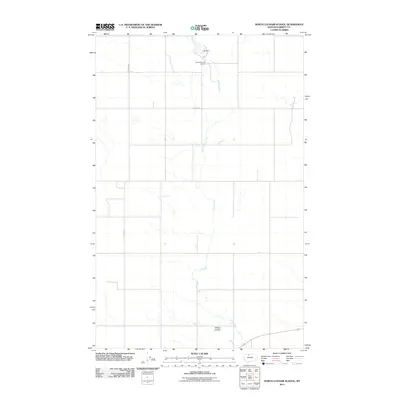
2011 Map of North Lothair School
USGS Topo · Published 2011About this map
Utopia Gas and Oil Field defines the industrial footprint of this northern Montana landscape, where the extraction of natural resources shapes the local geography. Situated in Liberty County, the area is characterized by a sparse network of section-line roads, including Utopia Rd and N Lothair Rd, which navigate the open prairie. Natural drainage is primarily managed by Eagle Creek, which flows through the center of the quadrangle and is arrested at the northern edge by Laas Dam. The presence of Sekora Coulee in the south provides a window into the typical landforms of this region, where seasonal runoff carved deep paths through the high plains. This 2011 survey reflects a modern era of land use where energy production and rural infrastructure intersect across the vast Montana interior.
Find a feature on this map
6 named features on this map. Tap any name to fly to it.
Don’t see what you’re looking for? This feature index may not catch every label — zoom into the map to look around manually.
Map Details
Editions of this 2011 North Lothair School Map
This is the sole edition of this map. No revisions or reprints were ever made.
Other maps of this area

1954 · Shelby
USGS Topo · 1:250,000

1958 · Shelby
USGS Topo · 1:250,000

1962 · Tiber
USGS Topo · 1:24,000

1962 · Lakey Ranch
USGS Topo · 1:24,000

1962 · North Lothair School
USGS Topo · 1:24,000

1962 · Berkholder Reservoir
USGS Topo · 1:24,000

1962 · Blair Ranch
USGS Topo · 1:24,000

1962 · Mc Carters Lake SE
USGS Topo · 1:24,000

1970 · Sagebrush Coulee
USGS Topo · 1:24,000

1970 · Galata
USGS Topo · 1:24,000