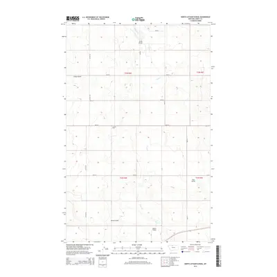
2014 Map of North Lothair School
USGS Topo · Published 2014About this map
The N Lothair School serves as a focal point for this expansive section of the High Plains in Liberty County. Defined by the meandering path of Eagle Creek, the landscape is etched with distinctive geographic formations including Galata Ravine and the branching draws of Sekora Coulee and Tiber Coulee. The presence of the Utopia Gas and Oil Field in the north indicates the region's intersection with Montana's energy industry, while the rigid grid of section lines and gravel roads like Lothair Rd and 3000 Rd S overlay the natural topography. This document provides a detailed layout of the rural infrastructure supporting the farming and ranching communities between the Marias River and the Canadian border.
Find a feature on this map
20 named features on this map. Tap any name to fly to it.
Don’t see what you’re looking for? This feature index may not catch every label — zoom into the map to look around manually.
Map Details
Editions of this 2014 North Lothair School Map
This is the sole edition of this map. No revisions or reprints were ever made.
Other maps of this area

1954 · Shelby
USGS Topo · 1:250,000

1958 · Shelby
USGS Topo · 1:250,000

1962 · Tiber
USGS Topo · 1:24,000

1962 · Lakey Ranch
USGS Topo · 1:24,000

1962 · North Lothair School
USGS Topo · 1:24,000

1962 · Berkholder Reservoir
USGS Topo · 1:24,000

1962 · Blair Ranch
USGS Topo · 1:24,000

1962 · Mc Carters Lake SE
USGS Topo · 1:24,000

1970 · Sagebrush Coulee
USGS Topo · 1:24,000

1970 · Galata
USGS Topo · 1:24,000