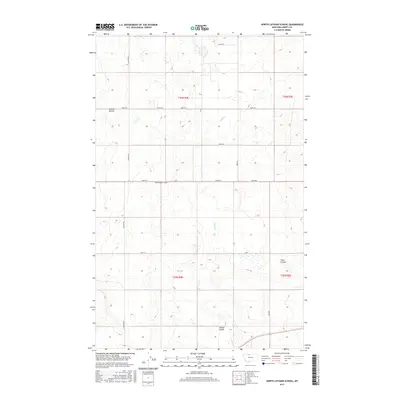
2017 Map of North Lothair School
USGS Topo · Published 2017About this map
North Lothair School stands as a central landmark in this high-plains landscape of Liberty County. The terrain is defined by the drainage patterns of Eagle Cr and the sharp incisions of local coulees, including Sekora Coulee and Tiber Coulee. These features represent the characteristic prairie breaks of the region, where seasonal water flow has carved distinct paths through the rolling acreage. The rectilinear grid of the Public Land Survey System is clearly visible, overlaid with a network of local thoroughfares such as Lothair Rd and Utopia Rd. This 2017 survey reflects the enduring spatial organization of Montana's agricultural heartland, where section lines dictate the placement of roads and the isolation of rural school sites.
Find a feature on this map
18 named features on this map. Tap any name to fly to it.
Don’t see what you’re looking for? This feature index may not catch every label — zoom into the map to look around manually.
Map Details
Editions of this 2017 North Lothair School Map
This is the sole edition of this map. No revisions or reprints were ever made.
Other maps of this area

1954 · Shelby
USGS Topo · 1:250,000

1958 · Shelby
USGS Topo · 1:250,000

1962 · Tiber
USGS Topo · 1:24,000

1962 · Lakey Ranch
USGS Topo · 1:24,000

1962 · North Lothair School
USGS Topo · 1:24,000

1962 · Berkholder Reservoir
USGS Topo · 1:24,000

1962 · Blair Ranch
USGS Topo · 1:24,000

1962 · Mc Carters Lake SE
USGS Topo · 1:24,000

1970 · Sagebrush Coulee
USGS Topo · 1:24,000

1970 · Galata
USGS Topo · 1:24,000