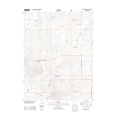
2013 Map of North Mamm Peak
USGS Topo · Published 2013About this map
White River National Forest defines much of this Garfield County landscape, where high-altitude mesas and deep gulches create a complex drainage network into the Colorado River. This area is characterized by massive landforms such as Battlement Mesa and Webster Mesa, which tower over the surrounding valley. The settlement at Tepee Park sits at a high elevation near the headwaters of Tepee Creek, illustrating the remote nature of human habitation in the high Colorado backcountry during this era.
Find a feature on this map
36 named features on this map. Tap any name to fly to it.
Don’t see what you’re looking for? This feature index may not catch every label — zoom into the map to look around manually.
Map Details
Editions of this 2013 North Mamm Peak Map
This is the sole edition of this map. No revisions or reprints were ever made.
Other maps of this area

1906 · Grand Hogback
USGS Topo · 1:125,000

1910 · Grand Hogback
USGS Topo · 1:125,000

1952 · Anvil Points
USGS Topo · 1:24,000

1952 · Rifle
USGS Topo · 1:24,000

1957 · Leadville
USGS Topo · 1:250,000

1959 · Leadville
USGS Topo · 1:250,000

1960 · Leadville
USGS Topo · 1:250,000

1960 · North Mamm Peak
USGS Topo · 1:24,000
1960 · Hawxhurst Creek
USGS Topo · 1:24,000

1960 · South Mamm Peak
USGS Topo · 1:24,000