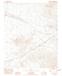
1983 Map of North of Baker
USGS Topo · Published 1983About this map
Silurian Valley dominates this arid landscape, serving as a catchment for runoff through drainage systems like Riggs Wash and Owl Canyon. The presence of Silurian Lake in the eastern portion of the sheet highlights the region's terminal drainage patterns characteristic of the Mojave. This 1983 provisional edition captures the footprint of mid-century industrial activity, particularly evident in the clusters of Mines and Prospects found throughout the Silurian Hills. A specifically noted Talc (Site) and a Borrow Pit indicate focused resource extraction during this era. Infrastructure developments are prominently marked by a Substation and Steel Tower Transmission Lines, showing how this remote corridor was utilized for regional energy transport and utility networks.
Find a feature on this map
13 named features on this map. Tap any name to fly to it.
Don’t see what you’re looking for? This feature index may not catch every label — zoom into the map to look around manually.
Map Details
Editions of this 1983 North of Baker Map
2 editions found
Other maps of this area

1910 · Ivanpah
USGS Topo · 1:250,000

1912 · Ivanpah
USGS Topo · 1:250,000

1933 · Avawatz Mountains
USGS Topo · 1:250,000

1942 · Ivanpah
USGS Topo · 1:250,000

1947 · Trona
USGS Topo · 1:250,000

1947 · Kingman
USGS Topo · 1:250,000

1948 · Kingman
USGS Topo · 1:250,000

1948 · Trona
USGS Topo · 1:250,000

1953 · Trona
USGS Topo · 1:250,000

1954 · Kingman
USGS Topo · 1:250,000