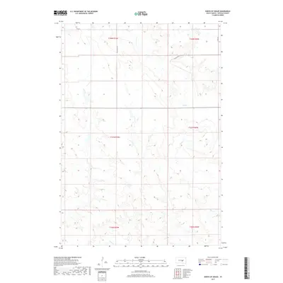
2017 Map of North of Shelby
USGS Topo · Published 2017About this map
The winding courses of Elm Cr and Crow Cr define the drainage of this Buffalo County landscape within the Crow Creek District. This modern topographical study captures the vast township-and-range section lines typical of the Dakotas, showcasing a sparse rural infrastructure centered on traditional section-line roads like 353rd Ave and 225th St. The terrain is characterized by a high frequency of contours and natural drainages that branch off the primary creeks, illustrating the complex hydrology of the Missouri Plateau. Local travel and land access are facilitated by named paths such as Ree Heights Rd and the descriptive Prairie Dog Ln, which navigate the elevation changes between township boundaries like t107n r70w and t108n r69w.
Find a feature on this map
12 named features on this map. Tap any name to fly to it.
Don’t see what you’re looking for? This feature index may not catch every label — zoom into the map to look around manually.
Map Details
Editions of this 2017 North of Shelby Map
This is the sole edition of this map. No revisions or reprints were ever made.
Other maps of this area

1935 · Chamberlain
USGS Topo · 1:62,500

1939 · Chamberlain
USGS Topo · 1:62,500

1941 · Pukwana
USGS Topo · 1:62,500

1951 · Pukwana
USGS Topo · 1:62,500

1953 · Huron
USGS Topo · 1:250,000

1954 · Huron
USGS Topo · 1:250,000

1955 · Mitchell
USGS Topo · 1:250,000

1959 · Mitchell
USGS Topo · 1:250,000

1966 · Big Bend Dam NE
USGS Topo · 1:24,000

1966 · Big Bend Dam SE
USGS Topo · 1:24,000
Featured Places
- Grant West Township, Crow Creek District
- Wilson Township, Crow Creek District
- Pershing Township, SD
- Grant East Township, SD
- Arlington Township, SD