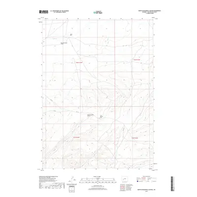
2017 Map of North Packsaddle Canyon
USGS Topo · Published 2017About this map
North Packsaddle Canyon and South Packsaddle Canyon define the high desert topography of this region in Sweetwater County. Located within the Jack Morrow Hills, the landscape is characterized by intricate drainage patterns that feed into Pacific Cr, Alkali Wash, and Alkali Cr. This 2017 survey illustrates the sparse, high-altitude terrain where human infrastructure is limited to primitive travel routes such as Bar X Rd and Co Rd 21. The map provides a detailed view of the township and range survey system, specifically covering parts of t26n r103w and surrounding blocks, which is essential for identifying specific land parcels in this remote part of Wyoming.
Find a feature on this map
12 named features on this map. Tap any name to fly to it.
Don’t see what you’re looking for? This feature index may not catch every label — zoom into the map to look around manually.
Map Details
Editions of this 2017 North Packsaddle Canyon Map
This is the sole edition of this map. No revisions or reprints were ever made.
Other maps of this area

1955 · Lander
USGS Topo · 1:250,000

1958 · Lander
USGS Topo · 1:250,000
1958 · Parting of the Ways
USGS Topo · 1:62,500
1958 · Essex Mountain
USGS Topo · 1:62,500
1958 · Hay Meadow Reservoir
USGS Topo · 1:24,000
1958 · Tule Butte
USGS Topo · 1:24,000
1958 · Pacific Springs
USGS Topo · 1:24,000
1958 · Parting of the Ways
USGS Topo · 1:24,000
1958 · Freighter Gap
USGS Topo · 1:62,500

1961 · Lander
USGS Topo · 1:250,000