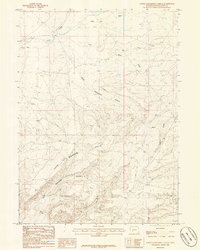
1986 Map of North Packsaddle Canyon
USGS Topo · Published 1986About this map
Morrow Hills dominates this high-desert landscape in Sweetwater County, where the terrain is deeply incised by a series of dramatic canyon systems. The survey details the convergence of North Packsaddle Canyon, South Packsaddle Canyon, and Jack Canyon, providing a clear record of the complex drainage patterns feeding into Pacific Creek. These geological features reflect the arid, wind-swept environment of southwestern Wyoming during the mid-1980s.
Find a feature on this map
8 named features on this map. Tap any name to fly to it.
Don’t see what you’re looking for? This feature index may not catch every label — zoom into the map to look around manually.
Map Details
Editions of this 1986 North Packsaddle Canyon Map
This is the sole edition of this map. No revisions or reprints were ever made.
Other maps of this area

1955 · Lander
USGS Topo · 1:250,000

1958 · Lander
USGS Topo · 1:250,000

1958 · Parting of the Ways
USGS Topo · 1:62,500

1958 · Essex Mountain
USGS Topo · 1:62,500

1958 · Hay Meadow Reservoir
USGS Topo · 1:24,000

1958 · Tule Butte
USGS Topo · 1:24,000

1958 · Pacific Springs
USGS Topo · 1:24,000

1958 · Parting of the Ways
USGS Topo · 1:24,000

1958 · Freighter Gap
USGS Topo · 1:62,500

1961 · Lander
USGS Topo · 1:250,000