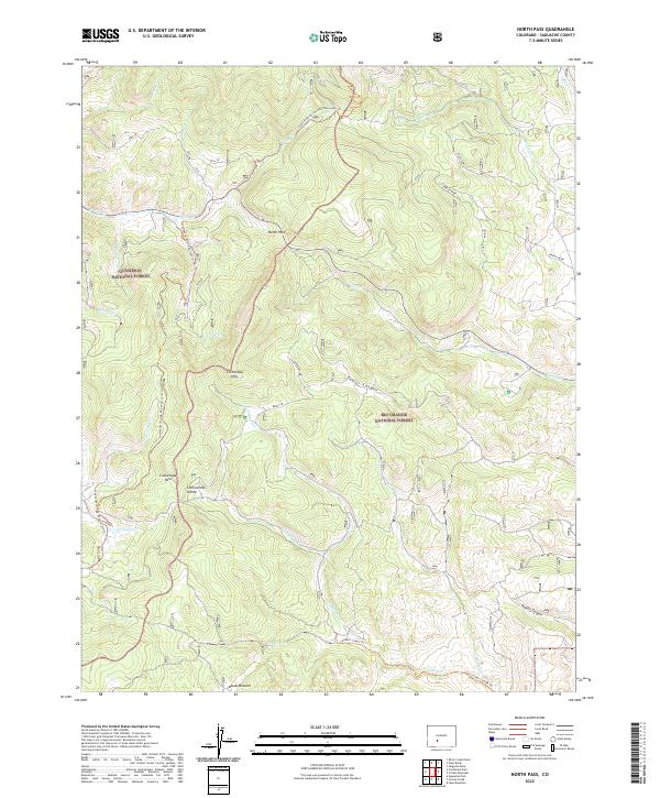
2022 Map of North Pass
USGS Topo · Published 2022About this map
The Continental Divide winds through this high-elevation portion of Saguache County, forming the boundary between the Gunnison National Forest and the Rio Grande National Forest. The landscape is dominated by the Cochetopa Hills and significant mountain crossings, including North Pass and Cochetopa Pass. This area is characterized by a dense network of watercourses such as Lujan Cr, Spanish Cr, and Archuleta Cr that drain the steep terrain of Taylor Canyon and Rabbit Canyon.
Find a feature on this map
34 named features on this map. Tap any name to fly to it.
Don’t see what you’re looking for? This feature index may not catch every label — zoom into the map to look around manually.
Map Details
Editions of this 2022 North Pass Map
This is the sole edition of this map. No revisions or reprints were ever made.
Other maps of this area

1956 · Montrose
USGS Topo · 1:250,000

1959 · Montrose
USGS Topo · 1:250,000

1960 · Montrose
USGS Topo · 1:250,000

1962 · West Baldy
USGS Topo · 1:24,000

1962 · Razor Creek Dome
USGS Topo · 1:24,000
1967 · North Pass
USGS Topo · 1:24,000

1967 · Sargents Mesa
USGS Topo · 1:24,000

1967 · Trickle Mountain
USGS Topo · 1:24,000
1967 · Grouse Creek
USGS Topo · 1:24,000
1967 · Saguache Park
USGS Topo · 1:24,000