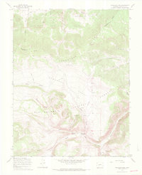
1967 Map of Saguache Park
USGS Topo · Published 1969About this map
The Continental Divide winds through this high-altitude landscape, serving as the watershed boundary between the Gunnison National Forest and the Rio Grande National Forest. At the heart of the sheet lies Saguache Park, a broad opening in the Cochetopa Hills where numerous drainages like Saguache Creek and Fourmile Creek originate. This 1967 survey captures the area’s management by the U.S. Forest Service, centered around the Stone Cellar Guard Station and the nearby Stone Cellar Campground. The terrain is defined by a dense network of high-country watercourses, including the Middle Fork and the Little North Fork Rio Grande. Notable landmarks such as Chimney Rock and Monchego Park provide distinct navigational points for those tracing the historic Pack Trail and Jeep Trail routes that cross these summits.
Find a feature on this map
31 named features on this map. Tap any name to fly to it.
Don’t see what you’re looking for? This feature index may not catch every label — zoom into the map to look around manually.
Map Details
Editions of this 1967 Saguache Park Map
3 editions found
Other maps of this area

1914 · Creede
USGS Topo · 1:125,000

1916 · Creede
USGS Topo · 1:125,000

1945 · Durango
USGS Topo · 1:250,000

1953 · Durango
USGS Topo · 1:250,000

1954 · Durango
USGS Topo · 1:250,000

1956 · Montrose
USGS Topo · 1:250,000

1959 · Montrose
USGS Topo · 1:250,000

1959 · Creede
USGS Topo · 1:62,500

1960 · Montrose
USGS Topo · 1:250,000

1961 · Durango
USGS Topo · 1:250,000