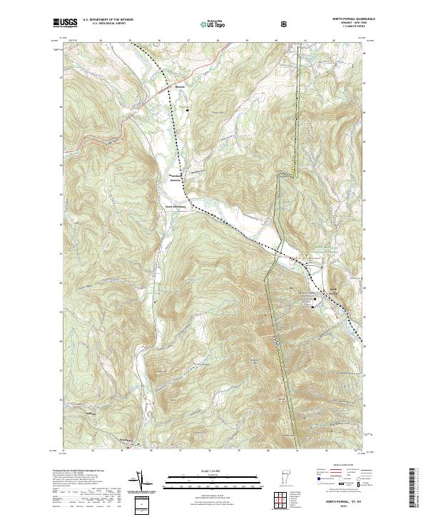
2024 Map of North Pownal
USGS Topo · Published 2024About this map
The Hoosic River and its tributary, the Little Hoosic River, carve a critical corridor through the Taconic Range where New York and Vermont meet. This map illustrates the intricate relationship between the mountainous terrain and human settlement, with communities like North Petersburg and Petersburg Junction clustered in the valley floors. Genealogists will find particular value in the documentation of several small burial sites, including the Edgar Rathburn Farm Cem and the Woodland - Wilcox Farm Cem near North Pownal. The eastern portion of the sheet is dominated by the steep slopes of the Green Mountain National Forest, where named hollows like Ellis Mine Hollow and Lincoln Hollow point toward a history of localized mountain industry and family landholdings. This geography creates a natural bottleneck for transit, as seen in the concentration of roads and rail routes following the water gaps.
Find a feature on this map
85 named features on this map. Tap any name to fly to it.
Don’t see what you’re looking for? This feature index may not catch every label — zoom into the map to look around manually.
Map Details
Editions of this 2024 North Pownal Map
This is the sole edition of this map. No revisions or reprints were ever made.
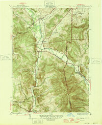
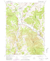
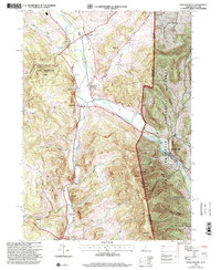
Historical Maps of Hoosick Through Time
4 maps found