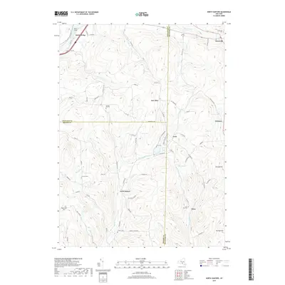
2019 Map of North Sanford
USGS Topo · Published 2019About this map
North Sanford lies at the intersection of Broome, Chenango, and Delaware counties, marking a landscape defined by upland ridges and small, dispersed rural settlements. The drainage patterns of Oquaga Creek and Cold Spring Creek shape the valleys between high points like Burnside Hill and Michigan Hill. This survey highlights the deep-rooted community geography of the region through its numerous local burial grounds, including the China Road Cemetery and Anthony Cemetery. In the northern portion of the sheet, the Susquehanna River cuts through the terrain near Middle Bridge, while the hamlet of Masonville serves as a local hub near the Masonville Creek headwaters. The map preserves the names of early educational and agricultural landmarks such as the Wheeler School Road, providing a clear view of the road network that connects these isolated hill communities.
Find a feature on this map
76 named features on this map. Tap any name to fly to it.
Don’t see what you’re looking for? This feature index may not catch every label — zoom into the map to look around manually.
Map Details
Editions of this 2019 North Sanford Map
This is the sole edition of this map. No revisions or reprints were ever made.
Other maps of this area

1902 · Coventry
USGS Topo · 1:62,500

1904 · Oxford
USGS Topo · 1:62,500

1905 · Nineveh
USGS Topo · 1:62,500

1915 · Unadilla
USGS Topo · 1:62,500

1918 · Unadilla
USGS Topo · 1:62,500

1924 · Deposit
USGS Topo · 1:62,500

1926 · Deposit
USGS Topo · 1:62,500

1943 · Sidney
USGS Topo · 1:24,000
1943 · Unadilla
USGS Topo · 1:24,000

1944 · Deposit
USGS Topo · 1:62,500