
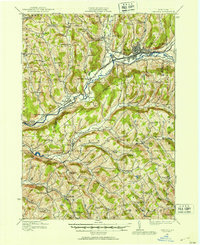
1915 Map of Unadilla
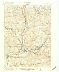
USGS Topo · Published 1961About this map
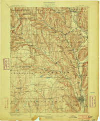
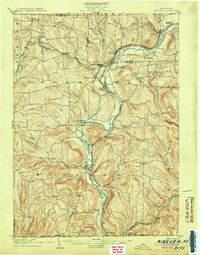
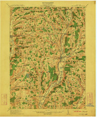
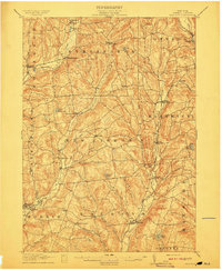
The Unadilla River and the Susquehanna River converge at Sidney, forming a vital corridor for transport and settlement in the early twentieth century. This survey documents the complex rail network of the New York Ontario and Western railroad as it winds through the valley, connecting hubs like Bainbridge and Rockdale. The landscape is dotted with rural institutions that reveal the social fabric of the era, from the Friends Meeting House in Unadilla to numerous numbered schoolhouses like Ives Settlement School and Shumway Hill School.
Find a feature on this map
106 named features on this map. Tap any name to fly to it.
Don’t see what you’re looking for? This feature index may not catch every label — zoom into the map to look around manually.
Map Details
Editions of this 1915 Unadilla Map
This is the sole edition of this map. No revisions or reprints were ever made.
Other maps of this area

1902 · Coventry
USGS Topo · 1:62,500
1903 · Norwich
USGS Topo · 1:62,500

1904 · Oxford
USGS Topo · 1:62,500
1905 · Nineveh
USGS Topo · 1:62,500

1910 · Hartwick
USGS Topo · 1:62,500

1910 · New Berlin
USGS Topo · 1:62,500
1912 · New Berlin
USGS Topo · 1:62,500
1912 · Hartwick
USGS Topo · 1:62,500
1915 · Oneonta
USGS Topo · 1:62,500
1918 · Unadilla
USGS Topo · 1:62,500