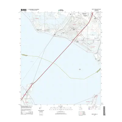
2015 Map of North Shore
USGS Topo · Published 2015About this map
Lake Pontchartrain dominates this coastal landscape, which depicts the southeastern fringes of Slidell and the residential expansion into the wetlands of St. Tammany Parish. The map illustrates a highly developed waterfront, where intricate canal systems define neighborhoods like Eden Isle and Oak Harbor. These man-made waterways contrast with the natural flow of Irish Bayou and Bayou de Lesaire to the south. Historically significant transport routes, including the Old Spanish Trl, intersect with modern developments such as Spanish Trail Highlands and Yester Oaks. The southern portion of the sheet is marked by the remote Point aux Herbes and Middle Ground, highlighting the boundary between the open lake and the marshy interior. Genealogical points of interest include Fields Cem, while local geography is anchored by coastal markers like Big Point and North Shore Beach.
Find a feature on this map
75 named features on this map. Tap any name to fly to it.
Don’t see what you’re looking for? This feature index may not catch every label — zoom into the map to look around manually.
Map Details
Editions of this 2015 North Shore Map
This is the sole edition of this map. No revisions or reprints were ever made.
Other maps of this area

1892 · Chef Menteur
USGS Topo · 1:62,500

1893 · Rigolets
USGS Topo · 1:62,500

1914 · Nicholson
USGS Topo · 1:62,500

1921 · Nicholson
USGS Topo · 1:62,500

1935 · Slidell
USGS Topo · 1:62,500

1936 · North Shore
USGS Topo · 1:31,680

1936 · South Point
USGS Topo · 1:31,680

1936 · Chef Menteur
USGS Topo · 1:62,500

1936 · Rigolets
USGS Topo · 1:62,500

1937 · Chef Menteur
USGS Topo · 1:31,680