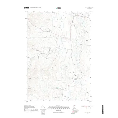
2018 Map of North Troy
USGS Topo · Published 2018About this map
The Missisquoi River valley anchors this 2018 survey of the borderlands in Orleans County. The northern settlement of North Troy serves as a focal point near the Canadian border, while the villages of Troy and Westfield lie further south along the river's winding path. This modern topographic study reveals a landscape defined by its cemetery network, including North Troy Cem and the Westfield Association Cem, which are vital landmarks for genealogists and local historians. To the west, the terrain rises sharply into the Green Mountains, featuring prominent peaks such as Gilpin Mtn and Domeys Dome. Notable civil features like the River Road Covered Bridge and Douglas Field highlight the local infrastructure and community spaces that persist in this corner of Vermont.
Find a feature on this map
74 named features on this map. Tap any name to fly to it.
Don’t see what you’re looking for? This feature index may not catch every label — zoom into the map to look around manually.
Map Details
Editions of this 2018 North Troy Map
This is the sole edition of this map. No revisions or reprints were ever made.
Other maps of this area

1919 · Montgomery
USGS Topo · 1:62,500

1920 · Montgomery
USGS Topo · 1:62,500

1920 · Irasburg
USGS Topo · 1:62,500

1923 · Irasburg
USGS Topo · 1:48,000

1925 · Irasburg
USGS Topo · 1:62,500

1925 · Jay Peak
USGS Topo · 1:62,500

1943 · Jay Peak
USGS Topo · 1:62,500

1950 · Lake Champlain
USGS Topo · 1:250,000

1953 · Jay Peak
USGS Topo · 1:62,500

1953 · Irasburg
USGS Topo · 1:62,500