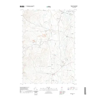
2021 Map of North Troy
USGS Topo · Published 2021About this map
North Troy and the surrounding borderlands of Orleans County are defined by the winding course of the Missisquoi River as it moves toward the Canadian border. This modern survey illustrates the enduring agricultural and village structure of the region, where settlements like Troy, Jay, and Westfield remain centered around their historic road networks and local cemeteries. The landscape shifts from the river valley flats near the River Road Covered Bridge to the significant elevations of the Green Mountains in the west, including Gilpin Mtn and the uniquely named Domeys Dome. Numerous mountain streams, such as Mountain Brook and Taft Brook, drain the high country, while Phillips Pond and the landmarks at Big Falls provide distinct points of interest within the varied terrain. This data serves as a precise record of the contemporary rural infrastructure and natural geography of northern Vermont.
Find a feature on this map
78 named features on this map. Tap any name to fly to it.
Don’t see what you’re looking for? This feature index may not catch every label — zoom into the map to look around manually.
Map Details
Editions of this 2021 North Troy Map
This is the sole edition of this map. No revisions or reprints were ever made.
Other maps of this area

1919 · Montgomery
USGS Topo · 1:62,500

1920 · Montgomery
USGS Topo · 1:62,500

1920 · Irasburg
USGS Topo · 1:62,500

1923 · Irasburg
USGS Topo · 1:48,000

1925 · Irasburg
USGS Topo · 1:62,500

1925 · Jay Peak
USGS Topo · 1:62,500

1943 · Jay Peak
USGS Topo · 1:62,500

1950 · Lake Champlain
USGS Topo · 1:250,000

1953 · Jay Peak
USGS Topo · 1:62,500

1953 · Irasburg
USGS Topo · 1:62,500