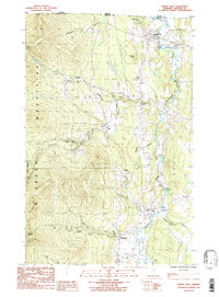
1986 Map of North Troy
USGS Topo · Published 1986About this map
The Missisquoi River winds through the northern Green Mountains in this mid-1980s survey, marking a landscape defined by the international border and rugged Vermont terrain. The settlement of North Troy serves as a key point of transit, highlighted by the presence of U S Customs at the edge of Canada United States. Further south, the villages of Troy, Jay, and Westfield anchor the valley, connected by local roads that follow the contours of the river and its tributaries like Coburn Brook and Beetle Brook.
Find a feature on this map
28 named features on this map. Tap any name to fly to it.
Don’t see what you’re looking for? This feature index may not catch every label — zoom into the map to look around manually.
Map Details
Editions of this 1986 North Troy Map
This is the sole edition of this map. No revisions or reprints were ever made.
Other maps of this area

1919 · Montgomery
USGS Topo · 1:62,500

1920 · Montgomery
USGS Topo · 1:62,500

1920 · Irasburg
USGS Topo · 1:62,500

1923 · Irasburg
USGS Topo · 1:48,000

1925 · Irasburg
USGS Topo · 1:62,500

1925 · Jay Peak
USGS Topo · 1:62,500

1943 · Jay Peak
USGS Topo · 1:62,500

1950 · Lake Champlain
USGS Topo · 1:250,000

1953 · Jay Peak
USGS Topo · 1:62,500

1953 · Irasburg
USGS Topo · 1:62,500