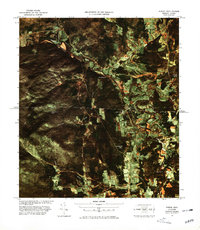
1978 Map of North Troy Station
USGS Topo · Published 1978About this map
The Missisquoi River winds through the borderlands of Vermont and Quebec, anchoring a landscape defined by international transit and small settlements. This 1978 color image map, produced through aerial photography, highlights the close proximity of North Troy in the United States to Highwater and Mansonville across the boundary. The strategic importance of this corridor is marked by the presence of North Troy Station U. S. Customs and Highwater Canadian Customs, which manage the flow of traffic where the Canadian Pacific railroad and local roads like Mc Comber Road cross the line.
Find a feature on this map
22 named features on this map. Tap any name to fly to it.
Don’t see what you’re looking for? This feature index may not catch every label — zoom into the map to look around manually.
Map Details
Editions of this 1978 North Troy Station Map
This is the sole edition of this map. No revisions or reprints were ever made.
Other maps of this area

1919 · Montgomery
USGS Topo · 1:62,500

1920 · Montgomery
USGS Topo · 1:62,500

1920 · Irasburg
USGS Topo · 1:62,500

1923 · Irasburg
USGS Topo · 1:48,000

1925 · Irasburg
USGS Topo · 1:62,500

1925 · Jay Peak
USGS Topo · 1:62,500

1943 · Jay Peak
USGS Topo · 1:62,500

1950 · Lake Champlain
USGS Topo · 1:250,000

1953 · Jay Peak
USGS Topo · 1:62,500

1953 · Irasburg
USGS Topo · 1:62,500