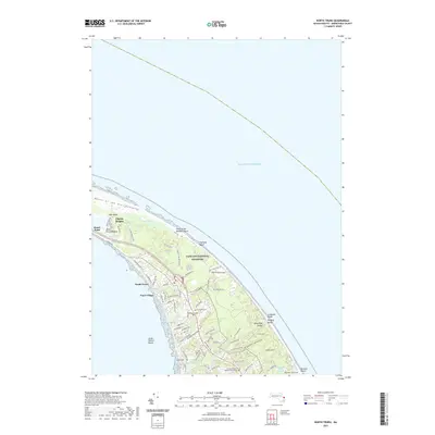
2021 Map of North Truro
USGS Topo · Published 2021About this map
North Truro and Pond Village anchor this coastal landscape where the outer Cape narrows between the Atlantic Ocean and the bay. The map documents a terrain defined by glacial history and maritime heritage, from the Dunes of the Provincelands in the northwest to the complex wetland systems of Salt Meadow and Little Pamet River Marshes. Local history is deeply etched into the land at the Hill of Churches and the nearby Hill of Storms Cem, while the Old North Cem sits further inland near Peters Hill. Much of the area falls within the Cape Cod National Seashore, preserving landforms such as Hanging Valley and the steep bluffs of The Highlands. Residential clusters like Beach Point and Corn Hill contrast with the open expanses of Pilgrim Spring and Moon Pond Meadow.
Find a feature on this map
79 named features on this map. Tap any name to fly to it.
Don’t see what you’re looking for? This feature index may not catch every label — zoom into the map to look around manually.
Map Details
Editions of this 2021 North Truro Map
This is the sole edition of this map. No revisions or reprints were ever made.
Other maps of this area

1887 · Wellfleet
USGS Topo · 1:62,500

1887 · Provincetown
USGS Topo · 1:62,500

1889 · Provincetown
USGS Topo · 1:62,500

1889 · Wellfleet
USGS Topo · 1:62,500

1893 · Wellfleet
USGS Topo · 1:62,500

1898 · Provincetown
USGS Topo · 1:62,500

1942 · Cape Cod Bay
USGS Topo · 1:125,000

1942 · Nauset
USGS Topo · 1:125,000

1944 · Provincetown
USGS Topo · 1:31,680

1944 · Wellfleet
USGS Topo · 1:31,680