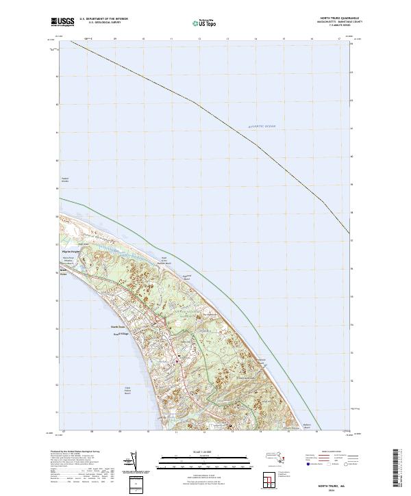
2024 Map of North Truro
USGS Topo · Published 2024About this map
North Truro and the adjacent Pond Village sit at the narrow northern end of Cape Cod, defined by the windswept landscape of the Cape Cod National Seashore. The terrain here is a complex mix of coastal geology, from the Dunes of the Provincelands and High Head to the dramatic elevation of Pilgrim Heights. Water dominates the landscape through features like Salt Meadow and Moon Pond, while the Little Pamet River carves through the southern section of the quadrangle. For genealogists and local historians, several landmark sites offer deep ties to the area's past, including the Old North Cem and the evocatively named Hills of Storms Cem near the Hill of Churches. The map captures a contemporary look at this historic maritime environment, where ancient names like Corn Hill and Higgins Hollow persist alongside protected shorelines.
Find a feature on this map
79 named features on this map. Tap any name to fly to it.
Don’t see what you’re looking for? This feature index may not catch every label — zoom into the map to look around manually.
Map Details
Editions of this 2024 North Truro Map
This is the sole edition of this map. No revisions or reprints were ever made.
Other maps of this area

1887 · Wellfleet
USGS Topo · 1:62,500

1887 · Provincetown
USGS Topo · 1:62,500

1889 · Provincetown
USGS Topo · 1:62,500

1889 · Wellfleet
USGS Topo · 1:62,500

1893 · Wellfleet
USGS Topo · 1:62,500

1898 · Provincetown
USGS Topo · 1:62,500

1942 · Cape Cod Bay
USGS Topo · 1:125,000

1942 · Nauset
USGS Topo · 1:125,000

1944 · Provincetown
USGS Topo · 1:31,680

1944 · Wellfleet
USGS Topo · 1:31,680