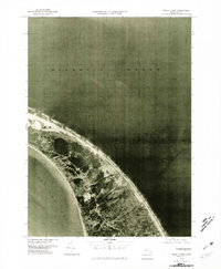
1977 Map of North Truro
USGS Topo · Published 1981About this map
North Truro sits as a narrow bridge of land on this orthophotoquad, showcasing the delicate balance between human settlement and the encroaching sea. Taken from aerial imagery in the late 1970s, this perspective captures the fine-grained texture of the coastal landscape, from the dense vegetation of the interior to the stark, white sand beaches that define the outer Cape. The vast expanse of the Atlantic Ocean dominates the eastern horizon, while the more sheltered waters of Cape Cod Bay border the western shoreline. This unique format uses rectified photoimagery rather than traditional topographic lines, allowing researchers to see the actual distribution of coastal scrub, residential development, and the shifting dune systems as they existed just before the turn of the decade. It provides a visual record of the shoreline and land use patterns in this thin stretch of the peninsula.
Find a feature on this map
3 named features on this map. Tap any name to fly to it.
Don’t see what you’re looking for? This feature index may not catch every label — zoom into the map to look around manually.
Map Details
Editions of this 1977 North Truro Map
This is the sole edition of this map. No revisions or reprints were ever made.
Other maps of this area

1887 · Wellfleet
USGS Topo · 1:62,500

1887 · Provincetown
USGS Topo · 1:62,500

1889 · Provincetown
USGS Topo · 1:62,500

1889 · Wellfleet
USGS Topo · 1:62,500

1893 · Wellfleet
USGS Topo · 1:62,500

1898 · Provincetown
USGS Topo · 1:62,500

1942 · Cape Cod Bay
USGS Topo · 1:125,000

1942 · Nauset
USGS Topo · 1:125,000

1944 · Provincetown
USGS Topo · 1:31,680

1944 · Wellfleet
USGS Topo · 1:31,680