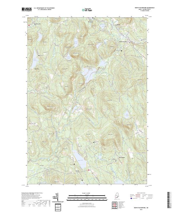
2024 Map of North Waterford
USGS Topo · Published 2024About this map
North Waterford and the surrounding Oxford County highlands are defined by a complex network of glacial ponds and narrow river valleys. The Crooked River winds through the northern reaches near Lynchville, while the Kezar River drains the southwest corner of the map past The Plains. This landscape is heavily shaped by its relief, with prominent peaks like Sabattus Mtn and Baldpate overlooking a series of small, dispersed settlements and family burial grounds. Local history is etched into the terrain at Kezar Falls Gorge and around Kezar Falls Hill, where the land drops toward Patterson Brook. For genealogists, the map identifies several distinct family cemeteries, including Stearns Cem, Brackett Cem, and Webber Cem, often located near historical homesteads and old roads like Plummer School Rd and Haskell Hill Rd.
Find a feature on this map
128 named features on this map. Tap any name to fly to it.
Don’t see what you’re looking for? This feature index may not catch every label — zoom into the map to look around manually.
Map Details
Editions of this 2024 North Waterford Map
This is the sole edition of this map. No revisions or reprints were ever made.
Other maps of this area

1896 · Norway
USGS Topo · 1:62,500

1909 · Fryeburg
USGS Topo · 1:62,500

1911 · Fryeburg
USGS Topo · 1:62,500

1911 · Bryant Pond
USGS Topo · 1:62,500

1914 · Bethel
USGS Topo · 1:62,500

1914 · Bryant Pond
USGS Topo · 1:62,500

1940 · Bethel
USGS Topo · 1:62,500

1941 · Bethel
USGS Topo · 1:62,500

1941 · Fryeburg
USGS Topo · 1:62,500

1942 · Bryant Pond
USGS Topo · 1:62,500