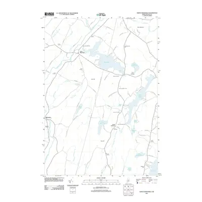
2011 Map of North Whitefield
USGS Topo · Published 2011About this map
North Whitefield and Whitefield anchor the Sheepscot River valley in this 2011 survey of Lincoln County, where the landscape is defined by a dense network of glacial ponds and small-scale water management. The legacy of local industry is visible at the Clary Saw Mill Dam on Clary Lake and the Boynton-Trask Dam further south. For genealogists, the map is particularly rich in family-named burial sites including the Potter Cemetery, Noyes Cemetery, Weeks Cemetery, and Hopkins Cemetery, many situated along rural routes like Hutton Rd and County Rd. The village of South Jefferson sits at a crossroads of the Dyer River, while high points such as Peter Mountain and Jones Hill offer perspective over a terrain dotted with recreational landmarks like the Health and Welfare Camp. Large water bodies including Dyer Long Pond, Musquash Pond, and the northern reach of Damariscotta Lake illustrate the area's transition into Maine's lake country.
Find a feature on this map
95 named features on this map. Tap any name to fly to it.
Don’t see what you’re looking for? This feature index may not catch every label — zoom into the map to look around manually.
Map Details
Editions of this 2011 North Whitefield Map
This is the sole edition of this map. No revisions or reprints were ever made.
Other maps of this area

1893 · Vassalboro
USGS Topo · 1:62,500

1893 · Wiscasset
USGS Topo · 1:62,500

1898 · Vassalboro
USGS Topo · 1:62,500

1913 · Waldoboro
USGS Topo · 1:48,000

1915 · Waldoboro
USGS Topo · 1:62,500

1916 · Liberty
USGS Topo · 1:62,500

1941 · Waldoboro
USGS Topo · 1:62,500

1941 · Vassalboro
USGS Topo · 1:62,500

1942 · Liberty
USGS Topo · 1:62,500

1943 · Vassalboro
USGS Topo · 1:62,500