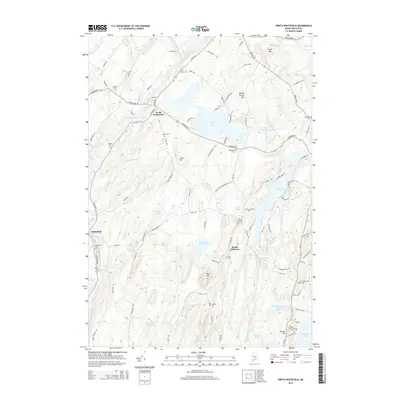
2014 Map of North Whitefield
USGS Topo · Published 2014About this map
The Sheepscot River and its west branch define the drainage of this Lincoln County landscape, winding past the village centers of North Whitefield and Whitefield. This 2014 survey reveals a territory defined by its water bodies and family-named cemeteries, reflecting generations of local land use. To the east, Clary Lake and Dyer Long Pond provide significant landmarks, while the Dyer River flows southward through South Jefferson. Notable elevations like Jones Hill and Bunker Hill rise between the pond-studded lowlands. Genealogists will find a high density of small family and local burial grounds, including the Preble Cem, Noyes Cem, and Weeks Cem. The road network, including the historic Grand Army Rd and Gardiner Rd, connects these scattered settlements and upland farms, tracing the same paths used since the nineteenth century.
Find a feature on this map
106 named features on this map. Tap any name to fly to it.
Don’t see what you’re looking for? This feature index may not catch every label — zoom into the map to look around manually.
Map Details
Editions of this 2014 North Whitefield Map
This is the sole edition of this map. No revisions or reprints were ever made.
Other maps of this area

1893 · Vassalboro
USGS Topo · 1:62,500

1893 · Wiscasset
USGS Topo · 1:62,500

1898 · Vassalboro
USGS Topo · 1:62,500

1913 · Waldoboro
USGS Topo · 1:48,000

1915 · Waldoboro
USGS Topo · 1:62,500

1916 · Liberty
USGS Topo · 1:62,500

1941 · Waldoboro
USGS Topo · 1:62,500

1941 · Vassalboro
USGS Topo · 1:62,500

1942 · Liberty
USGS Topo · 1:62,500

1943 · Vassalboro
USGS Topo · 1:62,500