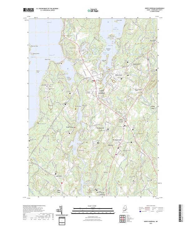
2024 Map of North Windham
USGS Topo · Published 2024About this map
Sebago Lake and the Presumpscot River anchor this landscape, where the contemporary commercial hub of North Windham meets several generations of rural settlement. The geography is defined by its water and hills, ranging from the depths of Jordan Bay and Little Sebago Lake to the heights of Boody Hill and Baker Mtn. For genealogists, the map is remarkably dense with family-named burial sites, including the Hanson Burial Ground, Mugford-Family Cem, and the Goudreau Family Burying Ground Cem. The southern reach of the map follows the river through North Gorham toward South Windham, showing the industrial-era legacy of dams like those forming Dundee Pond. Institutional landmarks such as Saint Joseph's College of Maine stand alongside local crossroads like Fosters Corner and Glantz Corner, illustrating the transition from scattered farming hamlets to modern educational and regional centers.
Find a feature on this map
225 named features on this map. Tap any name to fly to it.
Don’t see what you’re looking for? This feature index may not catch every label — zoom into the map to look around manually.
Map Details
Editions of this 2024 North Windham Map
This is the sole edition of this map. No revisions or reprints were ever made.
Other maps of this area

1891 · Portland
USGS Topo · 1:62,500

1891 · Buxton
USGS Topo · 1:62,500

1892 · Buxton
USGS Topo · 1:62,500

1893 · Portland
USGS Topo · 1:62,500

1893 · Buxton
USGS Topo · 1:62,500

1894 · Gray
USGS Topo · 1:62,500

1896 · Sebago
USGS Topo · 1:62,500

1898 · Gray
USGS Topo · 1:62,500

1914 · Portland
USGS Topo · 1:48,000

1916 · Portland
USGS Topo · 1:62,500