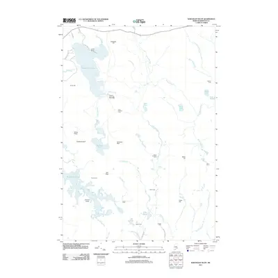
2011 Map of Northeast Bluff
USGS Topo · Published 2011About this map
Pleasant River Lake and its associated Pleasant River Lake Water Dam anchor the northern landscape of this Maine backcountry, where the Pleasant River winds southward through a network of camps and ridges. The map reveals a specific pattern of seasonal or sporting life, identifying numerous named sites such as Hartford Camp, Stewart Camp, and Irving Worcester Camp. These markers, alongside the namesake Northeast Bluff and Southwest Bluff, suggest a region defined by timber, recreation, and water management. To the southwest, the terrain opens into the Bog Brook Flowage, a complex wetland surrounding Dorman Island, while the eastern reaches are drained by the Little Mopang Stream and Mopang Stream. This detailed 2011 survey tracks the dirt roads and trails, such as Schoodic Pond Rd and Hatchery Rd, that provide access to these remote ponds and family-named landmarks.
Find a feature on this map
49 named features on this map. Tap any name to fly to it.
Don’t see what you’re looking for? This feature index may not catch every label — zoom into the map to look around manually.
Map Details
Editions of this 2011 Northeast Bluff Map
This is the sole edition of this map. No revisions or reprints were ever made.
Other maps of this area

1902 · Cherryfield
USGS Topo · 1:62,500

1904 · Cherryfield
USGS Topo · 1:62,500

1929 · Lead Mountain
USGS Topo · 1:48,000

1930 · Tunk Lake
USGS Topo · 1:48,000

1932 · Tunk Lake
USGS Topo · 1:62,500

1932 · Lead Mountain
USGS Topo · 1:62,500

1941 · Tug Mountain
USGS Topo · 1:62,500

1942 · Cherryfield
USGS Topo · 1:62,500

1942 · Tunk Lake
USGS Topo · 1:62,500

1943 · Tug Mountain
USGS Topo · 1:62,500