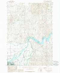
1985 Map of Northeast Emmett
USGS Topo · Published 1986About this map
The Payette River carves through the heart of this Gem County landscape, defining the agricultural and industrial character of the region in the mid-1980s. The town of Emmett sits at the southwestern edge of the valley, just south of the distinctive Emmett Bench. Irrigation is central to the area's development, evidenced by the extensive reach of the Last Chance Canal and the Canyon Canal, which draw from the river to support the Emmett Valley farmland. To the east, the Black Canyon Reservoir dominates the canyon narrows, bounded by steep terrain including Squaw Butte. This provisional survey preserves the location of smaller settlements like Plaza and geographic features such as Fuller Island and Ross Island, providing a clear look at the water-management infrastructure that sustained these Idaho communities before further modern expansion.
Find a feature on this map
27 named features on this map. Tap any name to fly to it.
Don’t see what you’re looking for? This feature index may not catch every label — zoom into the map to look around manually.
Map Details
Editions of this 1985 Northeast Emmett Map
This is the sole edition of this map. No revisions or reprints were ever made.
Other maps of this area

1892 · Boise
USGS Topo · 1:125,000

1894 · Squaw Creek
USGS Topo · 1:125,000

1897 · Boise
USGS Topo · 1:125,000

1897 · Weiser
USGS Topo · 1:125,000

1898 · Nampa
USGS Topo · 1:125,000

1953 · Montour
USGS Topo · 1:62,500

1955 · Baker
USGS Topo · 1:250,000

1955 · Boise
USGS Topo · 1:250,000

1958 · Boise
USGS Topo · 1:250,000

1959 · Baker
USGS Topo · 1:250,000