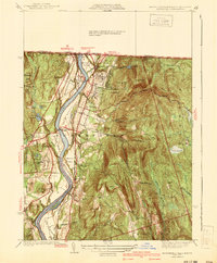
1941 Map of Northfield
USGS Topo · Published 1941About this map
The Connecticut River serves as the central artery for this portion of Franklin County, Massachusetts, winding past a series of fertile alluvial flats including Pauchaug Meadow and Beers Plain. The settlement of Northfield anchors the eastern bank, characterized by the expansive grounds of the Northfield Seminary and a transport network defined by the Boston and Maine Railroad. Across the water, the smaller community of Gill sits near the base of prominent heights like Grassy Hill.
Find a feature on this map
76 named features on this map. Tap any name to fly to it.
Don’t see what you’re looking for? This feature index may not catch every label — zoom into the map to look around manually.
Map Details
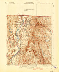
Editions of this 1941 Northfield Map
2 editions found
Other maps of this area

1887 · Warwick
USGS Topo · 1:62,500

1889 · Warwick
USGS Topo · 1:62,500

1890 · Greenfield
USGS Topo · 1:62,500

1891 · Brattleboro
USGS Topo · 1:62,500

1893 · Brattleboro
USGS Topo · 1:62,500

1894 · Greenfield
USGS Topo · 1:62,500

1894 · Warwick
USGS Topo · 1:62,500

1898 · Keene
USGS Topo · 1:62,500

1932 · Brattleboro
USGS Topo · 1:48,000

1932 · Warwick
USGS Topo · 1:48,000