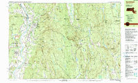
1990 Map of Northfield
USGS Topo · Published 1990About this map
Northfield and East Northfield serve as the primary hubs on this 1990 survey, situated along the broad meadows of the Connecticut River as it crosses the state border between Massachusetts, Vermont, and New Hampshire. The landscape is defined by its educational and transport history, anchored by the Northfield Mt Hermon School and the tracks of the Boston and Maine and Central Vermont railroads. The river is flanked by expansive plains like Beers Plain and Moose Plain, while the eastern portion of the map rises into the heavily wooded heights of Warwick State Forest and Mt Grace. Notable landmarks include the Schell Bridge and the Metacomet Monadnock Trail, reflecting a region that balances institutional growth with outdoor recreation. Small clusters such as Baptist Corners and Mayo Corners dot the upland roads, providing a view of the rural settlement patterns that persisted in Franklin County into the late 20th century.
Find a feature on this map
111 named features on this map. Tap any name to fly to it.
Don’t see what you’re looking for? This feature index may not catch every label — zoom into the map to look around manually.
Map Details
Editions of this 1990 Northfield Map
2 editions found
Other maps of this area

1887 · Warwick
USGS Topo · 1:62,500

1887 · Winchendon
USGS Topo · 1:62,500

1889 · Warwick
USGS Topo · 1:62,500

1890 · Greenfield
USGS Topo · 1:62,500

1890 · Winchendon
USGS Topo · 1:62,500

1891 · Brattleboro
USGS Topo · 1:62,500

1893 · Brattleboro
USGS Topo · 1:62,500

1894 · Winchendon
USGS Topo · 1:62,500

1894 · Greenfield
USGS Topo · 1:62,500

1894 · Warwick
USGS Topo · 1:62,500