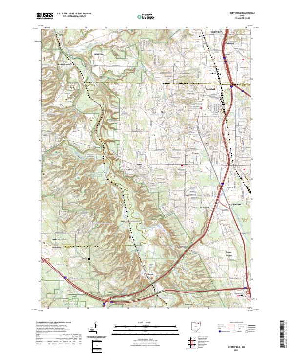
2023 Map of Northfield
USGS Topo · Published 2023About this map
Cuyahoga Valley National Park dominates the western half of this landscape, preserving the wooded corridor of the Cuyahoga River and its tributary systems. The terrain is defined by deep cuts from Tinkers Creek, Sagamore Run, and Brandywine Creek, the latter of which features the notable Brandywine Falls. This area illustrates the historical transition from industrial riverfront activity, represented by the company town site of Jaite, to modern residential suburbs like Sagamore Hills and Walton Hills. Genealogists will find several well-documented burial grounds, including the Northfield Macedonia Cem and the Boston Mills Cem. The map captures the meeting of major transportation arteries, with I-271 and I-80 cutting through the established communities of Northfield and Macedonia, providing a detailed look at how these late-century infrastructure developments reshaped the local topography and settlement patterns.
Find a feature on this map
39 named features on this map. Tap any name to fly to it.
Don’t see what you’re looking for? This feature index may not catch every label — zoom into the map to look around manually.
Map Details
Editions of this 2023 Northfield Map
This is the sole edition of this map. No revisions or reprints were ever made.
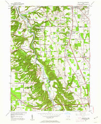
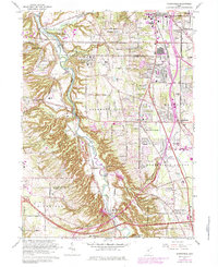
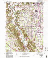
Historical Maps of Valley View Through Time
4 maps found