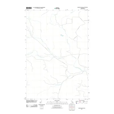
2011 Map of Northland NE
USGS Topo · Published 2011About this map
The West Branch Escanaba River meanders across this northern Michigan landscape, serving as the primary drainage for a network of waterways including Gleason Creek and Bryan Creek. This 2011 survey illustrates a region defined by its hydrography and a network of rural timber or service roads. Inland water features like Landon Lake are joined by multiple named brooks, such as Chandler Brook and Big Brook, indicating a low-lying, water-rich environment. The presence of Perrin Brothers Trl and Grade Rd suggests a history of local land use, possibly tied to the region's forestry or seasonal recreation. The map's grid-like road system, featuring County Road EAA and County Road EEX, provides a clear view of how these remote corridors navigate the wetlands and tributaries of the Escanaba River watershed.
Find a feature on this map
14 named features on this map. Tap any name to fly to it.
Don’t see what you’re looking for? This feature index may not catch every label — zoom into the map to look around manually.
Map Details
Editions of this 2011 Northland NE Map
This is the sole edition of this map. No revisions or reprints were ever made.
Other maps of this area

1932 · Helena NW
USGS Topo · 1:31,680

1932 · Harvey SW
USGS Topo · 1:31,680

1932 · Helena SW
USGS Topo · 1:31,680

1951 · Helena SW
USGS Topo · 1:31,680

1951 · Helena NW
USGS Topo · 1:31,680

1952 · Ishpeming
USGS Topo · 1:62,500

1952 · Gwinn
USGS Topo · 1:62,500

1952 · Gwinn
USGS Topo · 1:24,000

1957 · Northland
USGS Topo · 1:62,500

1958 · Marquette
USGS Topo · 1:250,000
Featured Places
- West Branch Township, MI
- Forsyth Township, MI
- Tilden Township, MI
- Wells Township, MI
- Marquette County, MI