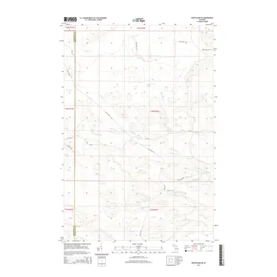
2014 Map of Northland NE
USGS Topo · Published 2014About this map
The W Br Escanaba River and its primary tributary, the West Branch Escanaba River, dominate this landscape at the border of Dickinson and Marquette counties. The drainage network is dense, fed by numerous named waterways including Chandler Brook, Big Brook, and Poplar Cr. This area is characterized by its heavy reliance on logging and transportation grades, evidenced by historical routes such as Kates Grade Rd and Ross Grade that cut through the township. These corridors, alongside local paths like Perrin Brothers Trl and Miller Creek Rd, reveal the long-standing importance of timber and land management in the Upper Peninsula. Central to the hydrography is Landon Lake, situated among a complex of smaller creeks like Bryan Cr and Gleason Cr that define the local topography.
Find a feature on this map
62 named features on this map. Tap any name to fly to it.
Don’t see what you’re looking for? This feature index may not catch every label — zoom into the map to look around manually.
Map Details
Editions of this 2014 Northland NE Map
This is the sole edition of this map. No revisions or reprints were ever made.
Other maps of this area

1932 · Helena NW
USGS Topo · 1:31,680

1932 · Harvey SW
USGS Topo · 1:31,680

1932 · Helena SW
USGS Topo · 1:31,680

1951 · Helena SW
USGS Topo · 1:31,680

1951 · Helena NW
USGS Topo · 1:31,680

1952 · Ishpeming
USGS Topo · 1:62,500

1952 · Gwinn
USGS Topo · 1:62,500

1952 · Gwinn
USGS Topo · 1:24,000

1957 · Northland
USGS Topo · 1:62,500

1958 · Marquette
USGS Topo · 1:250,000
Featured Places
- West Branch Township, MI
- Forsyth Township, MI
- Tilden Township, MI
- Wells Township, MI
- Marquette County, MI