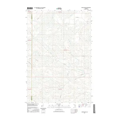
2017 Map of Northland NE
USGS Topo · Published 2017About this map
The West Branch Escanaba River and its various tributaries define this section of the Upper Peninsula at the boundary of Dickinson and Marquette counties. The landscape is heavily influenced by its logging and transit history, evidenced by the presence of Ross Grade and Ross Grade Rd, which follow established paths through the wooded terrain. Numerous small water bodies and wetlands are scattered throughout, including Landon Lake and Bobs Lake, while named waterways like Chandler Brook and Gleason Cr drain the surrounding highlands.
Find a feature on this map
31 named features on this map. Tap any name to fly to it.
Don’t see what you’re looking for? This feature index may not catch every label — zoom into the map to look around manually.
Map Details
Editions of this 2017 Northland NE Map
This is the sole edition of this map. No revisions or reprints were ever made.
Other maps of this area

1932 · Helena NW
USGS Topo · 1:31,680

1932 · Harvey SW
USGS Topo · 1:31,680

1932 · Helena SW
USGS Topo · 1:31,680

1951 · Helena SW
USGS Topo · 1:31,680

1951 · Helena NW
USGS Topo · 1:31,680

1952 · Ishpeming
USGS Topo · 1:62,500

1952 · Gwinn
USGS Topo · 1:62,500

1952 · Gwinn
USGS Topo · 1:24,000

1957 · Northland
USGS Topo · 1:62,500

1958 · Marquette
USGS Topo · 1:250,000
Featured Places
- West Branch Township, MI
- Forsyth Township, MI
- Tilden Township, MI
- Wells Township, MI
- Marquette County, MI