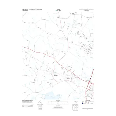
2013 Map of Northwest Goldsboro
USGS Topo · Published 2013About this map
The Neuse River serves as the southern boundary of this coastal plain landscape, where the confluence with Little River and the engineered waters of The Canal define the local hydrography. This 2013 survey illustrates a transition from the agricultural heritage found at Pike Crossroads and Peacock Crossroads toward the suburban growth of the Rosewood community. The map identifies several distinct residential developments including Peele Acres, Woodhaven, and Borden Homes, highlighting the expansion of the northwestern Goldsboro vicinity. Transport patterns are dictated by the 70 corridor and an intricate web of rural roads such as Pikeville Princeton Rd NW and Gurley Dairy Rd NW, which traverse the lowlands of Buck Swamp and Charles Br.
Find a feature on this map
183 named features on this map. Tap any name to fly to it.
Don’t see what you’re looking for? This feature index may not catch every label — zoom into the map to look around manually.
Map Details
Editions of this 2013 Northwest Goldsboro Map
This is the sole edition of this map. No revisions or reprints were ever made.
Other maps of this area

1902 · Kenly
USGS Topo · 1:62,500

1903 · Kenly
USGS Topo · 1:62,500

1904 · Wilson
USGS Topo · 1:62,500

1953 · Rocky Mount
USGS Topo · 1:250,000

1953 · Raleigh
USGS Topo · 1:250,000

1954 · Rocky Mount
USGS Topo · 1:250,000

1954 · Raleigh
USGS Topo · 1:250,000

1957 · Goldsboro
USGS Topo · 1:62,500

1974 · Grantham
USGS Topo · 1:24,000

1974 · Northwest Goldsboro
USGS Topo · 1:24,000