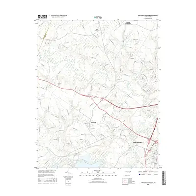
2016 Map of Northwest Goldsboro
USGS Topo · Published 2016About this map
Goldsboro and its northwestern outskirts are defined by the convergence of the Neuse River and the Little River during the mid-2010s. The landscape is characterized by a mix of established residential pockets and rural crossroads like Pike Crossroads and Peacock Crossroads. The area reflects a shift from agricultural land to suburban expansion, particularly around Rosewood. Notable water features such as Buck Swamp and Holland Br drain the low-lying terrain, while Cogdells Pond and Roses Pond serve as prominent local landmarks. For genealogists and local historians, the location of Evergreen Memorial Cem and numerous family-named roads, such as Gurley Dairy Rd and Hardy Talton Rd, provide specific geographical anchors for tracing twentieth-century property lines and community growth in Wayne County.
Find a feature on this map
143 named features on this map. Tap any name to fly to it.
Don’t see what you’re looking for? This feature index may not catch every label — zoom into the map to look around manually.
Map Details
Editions of this 2016 Northwest Goldsboro Map
This is the sole edition of this map. No revisions or reprints were ever made.
Other maps of this area

1902 · Kenly
USGS Topo · 1:62,500

1903 · Kenly
USGS Topo · 1:62,500

1904 · Wilson
USGS Topo · 1:62,500

1953 · Rocky Mount
USGS Topo · 1:250,000

1953 · Raleigh
USGS Topo · 1:250,000

1954 · Rocky Mount
USGS Topo · 1:250,000

1954 · Raleigh
USGS Topo · 1:250,000

1957 · Goldsboro
USGS Topo · 1:62,500

1974 · Grantham
USGS Topo · 1:24,000

1974 · Northwest Goldsboro
USGS Topo · 1:24,000