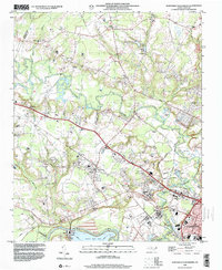
1998 Map of Northwest Goldsboro
USGS Topo · Published 2001About this map
The confluence of the Little River and the Neuse River anchors this landscape just west of Goldsboro in Wayne County. Significant institutional land use is evident at the Cherry Hospital complex and the nearby O'Berry Training Sch, while the rural residential character is defined by a dense network of crossroads and community churches. To the north, Pike Crossroads and Peacock Crossroads serve as local hubs, while settlements like Rosewood and Bordeaux sit amidst a landscape of agricultural fields and meandering waterways such as Buck Swamp and Peacock Branch.
Find a feature on this map
50 named features on this map. Tap any name to fly to it.
Don’t see what you’re looking for? This feature index may not catch every label — zoom into the map to look around manually.
Map Details
Editions of this 1998 Northwest Goldsboro Map
This is the sole edition of this map. No revisions or reprints were ever made.
Other maps of this area

1902 · Kenly
USGS Topo · 1:62,500

1903 · Kenly
USGS Topo · 1:62,500

1904 · Wilson
USGS Topo · 1:62,500

1953 · Rocky Mount
USGS Topo · 1:250,000

1953 · Raleigh
USGS Topo · 1:250,000

1954 · Rocky Mount
USGS Topo · 1:250,000

1954 · Raleigh
USGS Topo · 1:250,000

1957 · Goldsboro
USGS Topo · 1:62,500

1974 · Grantham
USGS Topo · 1:24,000

1974 · Northwest Goldsboro
USGS Topo · 1:24,000