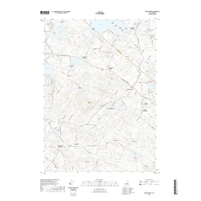
2021 Map of Northwood
USGS Topo · Published 2021About this map
Bow Lake and its intricate cluster of islands, including Loon Island and Pine Island, dominate the northern landscape of this region. The area is defined by several distinct village centers, most notably Northwood Center and Bow Lake Village, which serve as focal points for the surrounding rural roads. The terrain is marked by a series of significant heights such as Saddleback Mtn and Sherburne Hill, with numerous small water bodies like Lucas Pond and Harvey Lake interspersed throughout the hills.
Find a feature on this map
145 named features on this map. Tap any name to fly to it.
Don’t see what you’re looking for? This feature index may not catch every label — zoom into the map to look around manually.
Map Details
Editions of this 2021 Northwood Map
This is the sole edition of this map. No revisions or reprints were ever made.
Other maps of this area

1917 · Mt. Pawtuckaway
USGS Topo · 1:62,500

1919 · Mt. Pawtuckaway
USGS Topo · 1:62,500

1919 · Gilmanton
USGS Topo · 1:62,500

1919 · Alton
USGS Topo · 1:62,500

1921 · Suncook
USGS Topo · 1:62,500

1927 · Gilmanton
USGS Topo · 1:62,500

1939 · Mt. Pawtuckaway
USGS Topo · 1:62,500

1944 · Mt. Pawtuckaway
USGS Topo · 1:62,500

1944 · Suncook
USGS Topo · 1:62,500

1949 · Portland
USGS Topo · 1:250,000