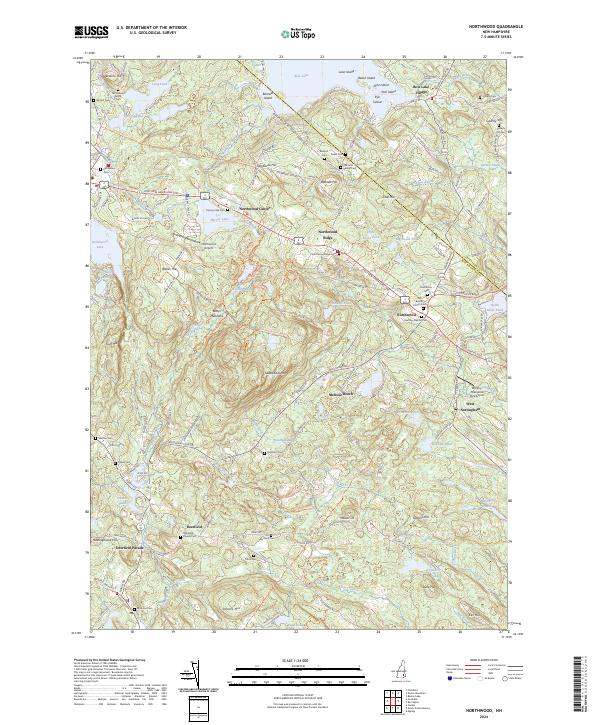
2024 Map of Northwood
USGS Topo · Published 2024About this map
Bow Lake Village and the high ridge of Northwood Ridge anchor this landscape along the Strafford and Rockingham county line. The terrain is defined by a series of drumlins and family-named elevations like Sherburne Hill and Caverly Hill, separated by a dense network of ponds and marshes. Local history is deeply etched into the land through numerous small burial grounds, including the Richardson Family Cem and the Old Baptist Church Cem. The road network follows the legacy of the First New Hampshire Tpke and the Old Turnpike Rd, which historically connected these upland settlements. From the shores of Northwood Lake to the southern reach of Deerfield Parade, the map illustrates a classic New England pattern of village clusters separated by forested slopes and wetlands like Woodman Marsh.
Find a feature on this map
86 named features on this map. Tap any name to fly to it.
Don’t see what you’re looking for? This feature index may not catch every label — zoom into the map to look around manually.
Map Details
Editions of this 2024 Northwood Map
This is the sole edition of this map. No revisions or reprints were ever made.
Other maps of this area

1917 · Mt. Pawtuckaway
USGS Topo · 1:62,500

1919 · Mt. Pawtuckaway
USGS Topo · 1:62,500

1919 · Gilmanton
USGS Topo · 1:62,500

1919 · Alton
USGS Topo · 1:62,500

1921 · Suncook
USGS Topo · 1:62,500

1927 · Gilmanton
USGS Topo · 1:62,500

1939 · Mt. Pawtuckaway
USGS Topo · 1:62,500

1944 · Mt. Pawtuckaway
USGS Topo · 1:62,500

1944 · Suncook
USGS Topo · 1:62,500

1949 · Portland
USGS Topo · 1:250,000