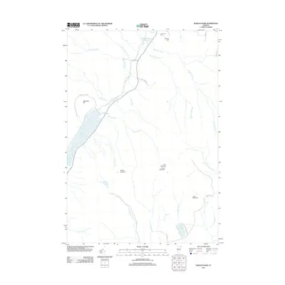
2012 Map of Norton Pond
USGS Topo · Published 2012About this map
Norton Pond and its surrounding highlands define this portion of Essex County, where the terrain transitions between the Coaticook River watershed and the upper reaches of the Nulhegan. This landscape is characterized by prominent peaks including Gore Mountain, Round Mountain, and Middle Mountain, which stand as landmarks over a dense network of watercourses like Sucker Brook and Tim-Carroll Brook. Near the northern border, the Old Catholic Cem and Church Hill indicate small clusters of historical settlement, while roads such as Blackburn Brook Rd and Gagnon Rd suggest the long-standing routes used for local transport and land management. The presence of both the N Br Nulhegan River and the Black Br Nulhegan River highlights the complex drainage patterns of this wooded interior, making it a significant area for studying the hydrological and topographical history of northeastern Vermont.
Find a feature on this map
36 named features on this map. Tap any name to fly to it.
Don’t see what you’re looking for? This feature index may not catch every label — zoom into the map to look around manually.
Map Details
Editions of this 2012 Norton Pond Map
This is the sole edition of this map. No revisions or reprints were ever made.
Other maps of this area

1924 · Island Pond
USGS Topo · 1:48,000

1926 · Island Pond
USGS Topo · 1:62,500

1929 · Averill
USGS Topo · 1:62,500

1949 · Jackman
USGS Topo · 1:250,000

1950 · Lewiston
USGS Topo · 1:250,000

1953 · Island Pond
USGS Topo · 1:62,500

1953 · Averill
USGS Topo · 1:62,500

1956 · Lewiston
USGS Topo · 1:250,000

1961 · Lewiston
USGS Topo · 1:250,000

1962 · Lewiston
USGS Topo · 1:250,000