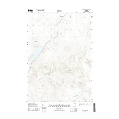
2015 Map of Norton Pond
USGS Topo · Published 2015About this map
The Old Catholic Cem sits on the northern edge of this Vermont landscape, overlooking the dense network of waterways that define the northern reaches of Essex County. The hydrology is dominated by the expansive Norton Pond to the west and the Coaticook River, which carves through the central valley. This 2015 survey illustrates a mountain-heavy terrain where the peaks of Gore Mtn, Mid Mtn, and Round Mtn form a central highland massif. These summits separate the northern drainage of Gaudette Brook and its numbered tributaries from the southern flow of the N Br Nulhegan River. The presence of several secluded water bodies, including Unknown Pond and Lewis Pond, suggests a remote and largely undeveloped environment, characterized by seasonal camps and limited access roads like Blackturn Brook Rd and Devost Camp Rd.
Find a feature on this map
37 named features on this map. Tap any name to fly to it.
Don’t see what you’re looking for? This feature index may not catch every label — zoom into the map to look around manually.
Map Details
Editions of this 2015 Norton Pond Map
This is the sole edition of this map. No revisions or reprints were ever made.
Other maps of this area

1924 · Island Pond
USGS Topo · 1:48,000

1926 · Island Pond
USGS Topo · 1:62,500

1929 · Averill
USGS Topo · 1:62,500

1949 · Jackman
USGS Topo · 1:250,000

1950 · Lewiston
USGS Topo · 1:250,000

1953 · Island Pond
USGS Topo · 1:62,500

1953 · Averill
USGS Topo · 1:62,500

1956 · Lewiston
USGS Topo · 1:250,000

1961 · Lewiston
USGS Topo · 1:250,000

1962 · Lewiston
USGS Topo · 1:250,000