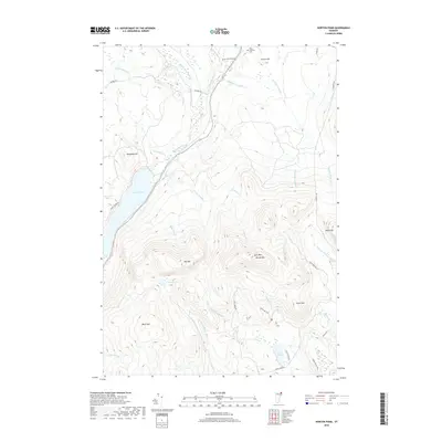
2018 Map of Norton Pond
USGS Topo · Published 2018About this map
The Coaticook River and Norton Pond anchor this landscape in the northern reaches of Vermont, where the terrain transitions into a complex of peaks and drainage basins. High elevations are defined by prominent landforms such as Gore Mtn Round Mtn, Bluff Mtn, and Lewis Mtn, while the Old Catholic Cem near Church Hill provides a specific point of interest for local history. The map captures a sophisticated network of water bodies, including the isolated Unknown Pond and the larger Lewis Pond at the southern end of the sheet.
Find a feature on this map
36 named features on this map. Tap any name to fly to it.
Don’t see what you’re looking for? This feature index may not catch every label — zoom into the map to look around manually.
Map Details
Editions of this 2018 Norton Pond Map
This is the sole edition of this map. No revisions or reprints were ever made.
Other maps of this area

1924 · Island Pond
USGS Topo · 1:48,000

1926 · Island Pond
USGS Topo · 1:62,500

1929 · Averill
USGS Topo · 1:62,500

1949 · Jackman
USGS Topo · 1:250,000

1950 · Lewiston
USGS Topo · 1:250,000

1953 · Island Pond
USGS Topo · 1:62,500

1953 · Averill
USGS Topo · 1:62,500

1956 · Lewiston
USGS Topo · 1:250,000

1961 · Lewiston
USGS Topo · 1:250,000

1962 · Lewiston
USGS Topo · 1:250,000