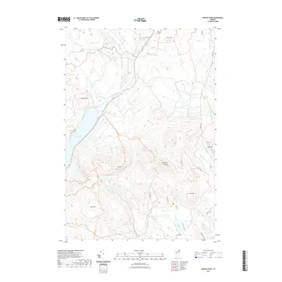
2021 Map of Norton Pond
USGS Topo · Published 2021About this map
Norton Pond and the high ridges of the Northeast Kingdom define this landscape in the early 2020s. The area is dominated by significant elevations such as Gore Mtn, Bluff Mtn, and Hedgehog Hill, which separate several distinct drainage basins. To the north, the Coaticook River and its tributaries like Sutton Brook and Station Brook flow toward the border, while the southern reaches are fed by the N Br Nulhegan River. The presence of the Old Catholic Cem near Church Hill provides a rare genealogical point of interest in an otherwise sparsely populated forest and mountain environment. Evidence of local recreation and timber access is visible through a network of trails and roads, including the Overlook Trl and Logger Brook Trl, which connect the isolated waters of Unknown Pond and Lewis Pond to the surrounding hillsides.
Find a feature on this map
37 named features on this map. Tap any name to fly to it.
Don’t see what you’re looking for? This feature index may not catch every label — zoom into the map to look around manually.
Map Details
Editions of this 2021 Norton Pond Map
This is the sole edition of this map. No revisions or reprints were ever made.
Other maps of this area

1924 · Island Pond
USGS Topo · 1:48,000

1926 · Island Pond
USGS Topo · 1:62,500

1929 · Averill
USGS Topo · 1:62,500

1949 · Jackman
USGS Topo · 1:250,000

1950 · Lewiston
USGS Topo · 1:250,000

1953 · Island Pond
USGS Topo · 1:62,500

1953 · Averill
USGS Topo · 1:62,500

1956 · Lewiston
USGS Topo · 1:250,000

1961 · Lewiston
USGS Topo · 1:250,000

1962 · Lewiston
USGS Topo · 1:250,000