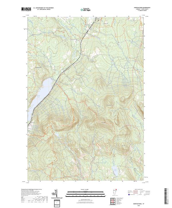
2024 Map of Norton Pond
USGS Topo · Published 2024About this map
Old Catholic Cem rests near the northern boundary of this Essex County landscape, situated along 105 Trl and a section of Closed (114) road. This modern digital survey documents a high-elevation wilderness dominated by the peaks of the Northeast Kingdom, including Gore Mtn, Bluff Mtn, and Mid Mtn. The terrain is defined by a complex network of timber and recreation paths such as the Gore Mountain Trl and Bluff Ridge Trl, reflecting the area's contemporary role within the Silvio O Conte National Fish and Wildlife Refuge.
Find a feature on this map
53 named features on this map. Tap any name to fly to it.
Don’t see what you’re looking for? This feature index may not catch every label — zoom into the map to look around manually.
Map Details
Editions of this 2024 Norton Pond Map
This is the sole edition of this map. No revisions or reprints were ever made.
Other maps of this area

1924 · Island Pond
USGS Topo · 1:48,000

1926 · Island Pond
USGS Topo · 1:62,500

1929 · Averill
USGS Topo · 1:62,500

1949 · Jackman
USGS Topo · 1:250,000

1950 · Lewiston
USGS Topo · 1:250,000

1953 · Island Pond
USGS Topo · 1:62,500

1953 · Averill
USGS Topo · 1:62,500

1956 · Lewiston
USGS Topo · 1:250,000

1961 · Lewiston
USGS Topo · 1:250,000

1962 · Lewiston
USGS Topo · 1:250,000