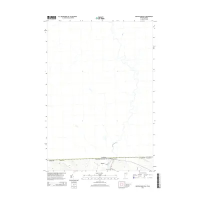
2015 Map of Norton Pond OE N
USGS Topo · Published 2015About this map
The international border between the United States and Canada defines the southern edge of this topographic study, where the settlement of Norton sits positioned directly against the boundary line. This 2015 survey reveals the hydrological network of northern Essex County, Vermont, as it transitions into Quebec, dominated by the northward flow of the Coaticook River. Local infrastructure is concentrated along the border, including Church Hill Rd and Nelson Rd, which serve the small community and provide access to Saint Bernards Cem. The surrounding terrain is characterized by a series of drainages, including Mosher Meadow Brook, Black Turn Brook, and Averill Cr, illustrating the watershed patterns that span the frontier in this sparsely developed region of the Northeast Kingdom.
Find a feature on this map
13 named features on this map. Tap any name to fly to it.
Don’t see what you’re looking for? This feature index may not catch every label — zoom into the map to look around manually.
Map Details
Editions of this 2015 Norton Pond OE N Map
This is the sole edition of this map. No revisions or reprints were ever made.
Other maps of this area

1924 · Island Pond
USGS Topo · 1:48,000

1926 · Island Pond
USGS Topo · 1:62,500

1929 · Averill
USGS Topo · 1:62,500

1949 · Jackman
USGS Topo · 1:250,000

1950 · Lewiston
USGS Topo · 1:250,000

1953 · Island Pond
USGS Topo · 1:62,500

1953 · Averill
USGS Topo · 1:62,500

1956 · Lewiston
USGS Topo · 1:250,000

1961 · Lewiston
USGS Topo · 1:250,000

1962 · Lewiston
USGS Topo · 1:250,000