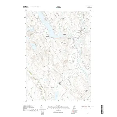
2021 Map of Norway
USGS Topo · Published 2021About this map
Pennesseewassee Lake dominates the central landscape of this western Maine region, anchoring the adjacent settlements of Norway and Norway Lake. The area's administrative importance is evident in South Paris, where the Oxford County Superior Courthouse and Maine District Court sit near the banks of the Little Androscoggin River. This modern survey illustrates the persistent cultural footprint of the 19th-century hill farms through numerous family-named peaks like Pike Hill, Frost Hill, and Hathaway Hill. Genealogists will find a dense network of burial grounds throughout the countryside, ranging from the Riverside Annex Cem in the east to the Caswells Corner Cem and Merrill Memorial Cem near Otisfield Gore in the south, reflecting the historical distribution of early townships and family plots.
Find a feature on this map
59 named features on this map. Tap any name to fly to it.
Don’t see what you’re looking for? This feature index may not catch every label — zoom into the map to look around manually.
Map Details
Editions of this 2021 Norway Map
This is the sole edition of this map. No revisions or reprints were ever made.
Other maps of this area

1896 · Norway
USGS Topo · 1:62,500

1908 · Poland
USGS Topo · 1:62,500

1911 · Bryant Pond
USGS Topo · 1:62,500

1911 · Buckfield
USGS Topo · 1:62,500

1913 · Buckfield
USGS Topo · 1:62,500

1914 · Bryant Pond
USGS Topo · 1:62,500

1940 · Poland
USGS Topo · 1:62,500

1942 · Buckfield
USGS Topo · 1:62,500

1942 · Bryant Pond
USGS Topo · 1:62,500

1942 · Poland
USGS Topo · 1:62,500